Sunday, July 17, 2016

Vore Buffalo Jump


The Vore Buffalo Jump located near Beulah, WY is the site of a natural sink hole used by various Plains Indian tribes to hunt and trap bison.  Used from about 1500 to 1800, and uncovered when construction began on I-90, the layers of well preserved bones and artifacts have given archaeologists a unique view of changes in hunting practices over the centuries.  Uncovered remains indicate that thousands of buffalo were harvested at this site alone.  


Exhibits and interpreters explain how the tribes would come together each fall and herd groups of about 200 buffalo toward the jump site.  At the last minute a stampede was initiated and the buffalo fell to their death.  The hunters then would descend into the sink hole and harvest meat, skins, bone...whatever they needed to prepare to survive the coming winter.  This method of hunting on foot appears to have declined once horses and firearms became available.

Devils Tower National Monument

On June 30 we left South Dakota and crossed the border into Wyoming.  Home base for a few days would be Mountain View RV Park & Campground in Sundance, Wyoming.


First agenda item was to visit Devils Tower National Monument.  In 1906 President Teddy Roosevelt designated Devils Tower as the nation's first national monument.  This massive structure was likely formed underground when igneous rock or volcanic magma filled a space in the surrounding sedimentary rocks, then cooled and hardened. Over time erosion wore away the sandstone and shale and exposed the columns that now are called Devils Tower.
At 865 feet high, the Tower offers some great rock climbing experiences for those brave enough to try.  Registration with the Park Service is required before climbing. We saw a couple pair of climbers on the day we were there.
We walked the 1.3 mile Tower Trail around the base of the stucture.  Huge piles of rubble created by fallen columns surround the base, offering novice "rock climbers" a chance to scramble around on the rocks.

After leaving Devils Tower we drove to Aladdin, WY...a tiny town of 13 residents.  There are two sites there: 1) the 100 year old general store that is now the grocery, hardware, clothing, antique, liquor store plus post office and 2) the pie shop next door.  A sign on the store announced the whole town is for sale for $1.5 million (in case someone is looking for an investment opportunity!).

Saturday, July 16, 2016

Spearfish Canyon Scenic Byway


Spearfish Canyon Scenic Byway (US Highway 14A) is 19 miles of rugged cliffs, sparkling creeks, lots of pines and spruce, and a couple magnificent waterfalls.  


We started the drive outside Spearfish, SD and followed the highway south toward Cheyenne Crossing (a historic stagecoach stop) at the junction of highway 85.

We stopped to see Bridal Veil Falls, which is located right along the highway, then drove off route a bit to see Roughneck Falls.  At Cheyenne Crossing we drove north again through Lead, Deadwood, and returned to Sturgis.

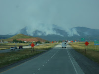
From the exit at Spearfish we had a view of our first forest fire...the Crow Peak fire, started by lightening during a recent thunderstorm, burned for over a week in the rugged timbered land.  Smoke from the fire could be seen for quite a distance and filled nearby canyons depending on the wind direction. 

Sturgis, Deadwood & Lead, South Dakota


It was a short drive from Heartland RV Park in Hermosa to Rush-No-More Campground in Sturgis, SD.  From there we explored the towns of Sturgis, Deadwood, and Lead.


Sturgis was a quiet little town, but that changes dramatically every August when hundreds of thousands of visitors arrive for its world famous motorcycle rally.  We found many of the downtown stores minimally open, but busily preparing for the upcoming event.  We stopped to see Knuckles Bar with all it's motorcycle memorabilia.

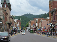
Deadwood, a historic mining town with lots of local stories of gold, gambling, and rowdy characters, was fun to visit.  We saw the saloon where Wild Bill Hickok was shot, and the cemetery (Mt. Moriah) high above main street where he and other local characters (Calamity Jane, Madam Dora DuFran, Potato Creek Johnny, Preacher Smith, Seth Bullock and Colorado Charlie Utter) are buried.  A tram tour took us to see the historic sites.

Lead, site of the Homestake Gold Mine from 1870's until 2002, one of the longest continually operating gold mines in America.  It is also recognized as the oldest, largest, and deepest mines (shafts descend more than 8000 feet below the surface) in the western hemisphere. Since closing it has been re-purposed by Sanford Lab as a Deep Underground Science and Engineering Laboratory.

Wind Cave National Park


Not far from the Mammoth Site in Hot Springs is the entrance to Wind Cave National Park.
Established in 1903, this was the eighth national park created and the first to protect a cave. Now with over 140 miles of mapped passageways, it is one of the longest caves known.  "Boxwork," an unusual formation found within the cave, is unique to Wind Cave. The natural entrance to the cave is a sacred site to local native Americans.

Above the surface, the park is a protected home for wildlife, including a herd of bison.  Elk, mule deer, pronghorn antelope, and prairie dogs are also found.

Also on site are buildings and structures dating back to the 1930's built by the Civilian Conservation corps.  We did not tour the cave itself, but spent lots of time viewing the extensive displays at the visitor center.

The Mammoth Site of Hot Springs, SD


The Mammoth Site is the final resting place for large Columbian and Woolly mammoths that became trapped about 25,000 years ago.  It is believed the animals were drawn to this spring-fed sinkhole, then slid in and were unable to escape.  So far remains of 61 of the huge animals have been discovered. 

Accredited by the American Alliance of Museums, this in-situ (bones left as found) site is an actively working excavation.  The entire site is now located within a huge building, to protect the bones from weather damage. In addition to the mammoths, bones of camels, wolves, and giant short-faced bear have been found.


Custer State Park & Black Hills National Forest, South Dakota


After leaving the Badlands, we settled into a campground near Hermosa, SD.  It was south of Rapid City, but gave us good access to Custer State Park and the South Dakota Black Hills.
   In Custer State Park we drove the Wildlife Loop Road and saw bison (buffalo), wild burros, deer, elk, antelope, and prairie dogs.  Another day we followed the Needles Highway...full of twists and turns, narrow tunnels, and towering rocky peaks.  Iron Mountain Road was our final route within the park.  It is known for it's pigtail bridges and tunnels that are strategically placed so the openings frame Mount Rushmore.


From the town of Custer we drove to Keystone to see Mount Rushmore National Memorial. Along the highway we could see Crazy Horse Memorial, a work in progress but now with a definite face appearing in the rock. We took day trips driving through Black Hills National Forest, and went into Rapid City for groceries and supplies. We spent a total of 10 days in this area, and drove many miles with the Honda!

Prairie Homestead National Historic Site


Prairie Homestead is located near one entrance to Badlands National Park.  This site preserves one of the only known intact original sod farm houses on the prairie.  This pioneer home was built in 1909 when the land was homesteaded by Mr. & Mrs. Ed Brown who came from Nebraska. The 160 acre homestead cost them $80.  The home was built of dirt sod bricks. After they left, it was occupied until 1949 by Mr. George Carr.

All the buildings are as they were found, except for minor restoration and maintenance.  A storage cave dug into the hills had collapsed, so it was dug out and restored in 1966.

In 1974 the site was added to the National Register of Historic Places. 

Badlands National Park South Dakota


 Badlands National Monument was established in 1939 and became Badlands National Park in 1978.  At one time the proposed name for this park was Teton National Park to avoid the negative-sounding name "Badlands".   It's 244,000 acres contain rich fossil beds, deep canyons, towering spires and flatland buttes.  Erosion by wind and water is constantly changing the appearance of Badlands rock structures.
We spent several days exploring Badlands National Park from our campground at Interior, SD.   We drove scenic Hwy 240 through the park. This Loop Road follows the Badlands wall, a long narrow spine of formations that stretch for some 60 miles. Our National Parks Golden Pass allowed us to enter many times.  


At the end of our drive one day we were lucky enough to see some bighorn sheep wandering along the road and resting on stone ledges not far away.


A vacation in the Badlands would be incomplete without a trip to Wall Drug.  It seemed bigger and contained lots more shopping than we remembered from previous trips.

Toward the Badlands

We left Minnesota in June and headed West...first stop was Watertown, South Dakota.  We camped there a couple days at Stokes-Thomas Lake City Park...a nice park right on Lake Kampeska. Watertown has an impressive Terry Redlin art museum/gallery on the east edge of town near the junction of I-29 and highway 212.

Next destination was near Gettysburg, South Dakota.  We chose a campsite at South Whitlock Recreation Area, a huge area along the Missouri River with access to Lake Oahe.  Formed by a dam near Pierre, SD Lake Oahe is a very active fishing lake.  In the fall the area supports pheasant and deer hunting.

A road trip one day lead us to Hoven, South Dakota, a little town of about 500 persons.  What puts this little town on the map is its Cathedral of the Prairie (St. Anthony of Padua Catholic Church). Completed in 1921, and now registered as a historic place, the massive church seats over 1000; twin spires reach 140 feet toward the heavens; the interior walls are covered with intricate, ornate stenciling.  It is believed to have been patterned after a church in Bavaria.  A walk through the cemetery revealed a gravestone containing a familiar family name!  Some of our relatives had been here...

From Gettysburg we drove south through Pierre then toward Rapid City. While driving along highway 14 we learned we were following the "Old Deadwood Trail"....signs along the way marked sites where stage coach stops had once been and where wagon wheel ruts were still visible in nearby fields.