Thursday, August 4, 2016

Glacier National Park: East Glacier


Our final trip into Glacier Park was to the Two Medicine area.  Two Medicine offers hiking and camping, and another clear blue lake.  We stopped to see Running Eagle Falls, accessible by a short walk into the woods and across a small stream.

On the way out we stopped in East Glacier to see historic Glacier Park Lodge.  This lodge was built in 1912 by the Great Northern Railroad (GNR) company.  GNR financed the building of many hotels and lodges in Glacier Park as part of their "See America First" campaign.  East Coast and Midwest travelers were invited to hop on the train and come visit the west, assuring that fine lodging, dining, and travel would be available.  

This lodge is best known for the massive Douglas fir pillars used in it's construction.


Glacier National Park: Many Glacier


Another day we drove to the north-east corner of the park to Many Glacier.  This area is a favorite for hikers, since many trails leave from there. Swiftcurrent Lake is the central point and site of historic Many Glacier Hotel.  This century old Swiss influenced hotel perches on the lake shore and faces a jagged skyline of rocky peaks.  There are fewer trees on this side due to less moisture.


.


Just as we drove in we got to see a bear!  It was in the bushes feasting on berries, not too far off the main road.

Glacier National Park: West Glacier

In 1910 Glacier National Park was established as our country's 10th national park.


We first entered the park at West Glacier and followed Going to the Sun Road, 52 miles of two lane highway that winds through the heart of Glacier Park and exits on the east side at St. Mary.  Going to the Sun was completed in 1923 after 10 years of engineering.  Stone work on the bridges, tunnels, guard rails & retaining walls artfully blends into the adjoining hills.  In recent years renovations have added more turn outs and scenic overlooks.

The Road starts gently in the Lake McDonald valley, winding past the largest lake in Glacier: 9 miles long, 1.5 miles wide, and nearly 500 feet deep.  McDonald Lodge, built in 1913, is now on the historic buildings registry, and still serves guests in it's hotel rooms and cabins.

From the lake, Going to the Sun climbs to "The Loop".  The only switchback on the road, it makes a full U-turn, then the road climbs at a steady 6% grade around curves and bends until it reachs Logan Pass.  At 6640 feet, this is the highest point accessible by road (many mountain peaks are much higher!)

At Triple Divide Peak, which straddles the Continental Divide, water flows in three directions: toward the Pacific Ocean, Hudson Bay, and the Gulf of Mexico.

Coming down the east side, one gets a chance to see Jackson Glacier, one of a few still present in the park.  


Then it's on to St Mary valley, where grassy meadows provide food for elk and other animals.  To complete the round trip and get back to our campground on the west side, we took highways 89 and 2 back to West Glacier.

Wednesday, August 3, 2016

On the Way to Glacier National Park

On July 18th we left Wyoming and headed north on I-90 into Montana.  We followed the Yellowstone River to Bozeman; crossed the Continental Divide near Butte; turned south at Missoula on hwy 93 and into the Bitterroot National Forest region.  The Bitterroot River wound it's way through the forest and towns.


Near Stevensville, we stopped to visit relatives on their Montana farm. We parked in the farm yard and camped there a couple days.  Some of their cattle came to pose for pictures one afternoon.

Leaving Stevensville we headed north again, through Missoula and up hwy 93 to Flathead Lake.  Flathead Lake is one of the largest freshwater lakes west of the Mississippi. We drove around the east side of the lake, to see the Flathead cherry orchards. Flathead cherries were advertised at grocery stores and little fruit stands along the way, so we stopped to buy some...they are Bing cherries, and were quite good. Another fruit in season was huckleberry, which they used for pies, ice cream, jam, jelly, etc. (kind of like blueberries).

Our destination was a campground in Kalispell, MT.  It was from Kalispell that we started our tour of Glacier National Park.  We would be touring Glacier Park for a week: July 22-29th.

Buffalo, Wyoming


Buffalo, WY is another western town with lots of history.  The Occidental Hotel in Buffalo, originally built in the late 1800's to serve travelers of the Bozeman Trail, has hosted many notorious guests over the years.  Butch Cassidy, the Sundance Kid, Jesse James and the Hole-in-the-Wall gang, Calamity Jane, Buffalo Bill Cody, Tom Horn, Teddy Roosevelt, President Herbert Hoover and Ernest Hemingway are only a few.


 Bullet holes in the walls and ceiling of the hotel saloon attest to the wild days in town and characters that lived there.

Both Buffalo and Kaycee, WY (just south of Buffalo) had great western history museums, with lots of stories and artifacts from the area.  The Johnson County Cattle Wars, TA Ranch gunfight, Hole-in-the Wall hideout, the Wagon Box Fight, Fort Phil Kearny, Fetterman Battlefield, Dull Knife Battle...all places and events in the history of these towns along the Bighorn Mountains.

If you are a fan of "Longmire" series on either A&E Television or Netflix, or have read novels by author Craig Johnson, the town of Buffalo may seem familiar.  Johnson loosely bases his stories on events and characters from this Wyoming town.

P.S. a bit of Wyoming trivia: according to the host at Buffalo's Visitor Center...there are more antelope in Wyoming than people! (I'd believe it too...we saw antelope every place we drove)

Sheridan, Wyoming

Sheridan, WY is a town rich with Old West history; we spent hours in the excellent museums, historic buildings, and surrounding towns and countryside.

Coal mining was responsible for growth of Sheridan County area in the late 1890's to early 1900's. Monarch, Dietz, Acme, Kooi, Kleenburn were local mining towns...now all that remains are a couple water towers, some concrete foundations, small cemeteries, and a boarded up mine shaft opening. We followed the Black Diamond Trail to visit some of these ghost towns.  As the mines closed in the 1930's, residents moved into Sheridan.

Shaft coal mining eventually brought the railroad to Sheridan.  Timber from nearby Bighorn Mountains was used for railroad ties; massive flumes were constructed to bring logs down the mountains to the rail lines being built. The railroad company bought and transported coal to larger markets in the northwest.

The Sheridan Inn grew from the need for a place for train passengers to stay. Opened in 1893, it was one of the first western hotels to feature running water and electricity.   Buffalo Bill Cody auditioned riders for his Wild West Shows from the Inn.  Another notable guest of the 1920's was Ernest Hemingway.  The Inn is also known as "House of 69 Gables" for all the gabled windows on the upper floor guest rooms.

The Bozeman Trail route ran through nearby town of Big Horn...some wagon ruts from the trail are still visible on the hills along I-90.


Also in Sheridan is King's Saddlery Museum...a collection of saddles, ropes, and western memorabilia. Craftsmen there still embellish saddles and other leather goods with fine tooling.

(Sorry for so few photos; our camera was broken during one of our outings in this area)

Bighorn Mountains Wyoming

From July 5 we spent about two weeks near the Bighorn Mountains in Wyoming.  Our time was divided between campgrounds in Sheridan, WY and Buffalo, WY.

Out of Sheridan, we drove the Bighorn Scenic Byway which follows highway 14 over the mountains from Ranchester to Greybull, WY.  This route takes you quickly up the east mountain face, with many switchbacks and hairpin curves. Granite Pass, at 8860 feet, takes you over the top through Cloud Peak Wilderness Area. Then, it's downhill through Shell Canyon.  We stopped to see Shell Falls along the way.

Another day, we drove out of Buffalo and followed Cloud Peak Scenic Byway.  This route follows highway 16, across Powder Pass at 9666 feet, then down through Ten Sleep Canyon. We had lunch at the little town of Ten Sleep.  On the way back, we diverted our drive to experience Crazy Woman Canyon...down hill, on a single lane dirt and rocky road, along rushing streams, to the canyon floor where huge rocks nearly blocked the way, then out into a rolling grassland.  It was a bit scary, but a neat experience!

These scenic drives were done with the car. RV travel is not recommended on hwy 14, especially on hwy 14a which diverts at Burgess Junction.  All RV's and vehicles towing anything are met by a large yellow sign warning of the 10% grades you will experience. RV travel on hwy 16 is doable, as there are pull-outs.  One is not reassured, though, when met with a "runaway truck ramp 3 miles" sign along the way!

Black Hills Roundup Rodeo

On July 4th we drove from Sundance, WY to Belle Fourche, SD for the annual Black Hills Roundup Rodeo.  The day started with a parade...color guard, marching bands, floats, princesses and politicians, farm tractors and fire trucks, and of course HORSES. After the parade, we grabbed some lunch at the local truck stop diner, then headed to the rodeo grounds.

Black Hills Roundup Rodeo is one of the nation's premier rodeo events, with participants from many states.  It is held every July 4th weekend.  In a state where rodeo is probably more popular than football, lots of local champions were present too.

Historically, great herds of cattle were gathered and driven on hoof from the open ranges of the Northern Plains to Belle Fourche for shipping to the east.  The last big cattle roundup was in 1902. Currently a smaller version of a cattle drive is recreated and takes place the weekend of the rodeo.

Sunday, July 17, 2016

Vore Buffalo Jump


The Vore Buffalo Jump located near Beulah, WY is the site of a natural sink hole used by various Plains Indian tribes to hunt and trap bison.  Used from about 1500 to 1800, and uncovered when construction began on I-90, the layers of well preserved bones and artifacts have given archaeologists a unique view of changes in hunting practices over the centuries.  Uncovered remains indicate that thousands of buffalo were harvested at this site alone.  


Exhibits and interpreters explain how the tribes would come together each fall and herd groups of about 200 buffalo toward the jump site.  At the last minute a stampede was initiated and the buffalo fell to their death.  The hunters then would descend into the sink hole and harvest meat, skins, bone...whatever they needed to prepare to survive the coming winter.  This method of hunting on foot appears to have declined once horses and firearms became available.

Devils Tower National Monument

On June 30 we left South Dakota and crossed the border into Wyoming.  Home base for a few days would be Mountain View RV Park & Campground in Sundance, Wyoming.


First agenda item was to visit Devils Tower National Monument.  In 1906 President Teddy Roosevelt designated Devils Tower as the nation's first national monument.  This massive structure was likely formed underground when igneous rock or volcanic magma filled a space in the surrounding sedimentary rocks, then cooled and hardened. Over time erosion wore away the sandstone and shale and exposed the columns that now are called Devils Tower.
At 865 feet high, the Tower offers some great rock climbing experiences for those brave enough to try.  Registration with the Park Service is required before climbing. We saw a couple pair of climbers on the day we were there.
We walked the 1.3 mile Tower Trail around the base of the stucture.  Huge piles of rubble created by fallen columns surround the base, offering novice "rock climbers" a chance to scramble around on the rocks.

After leaving Devils Tower we drove to Aladdin, WY...a tiny town of 13 residents.  There are two sites there: 1) the 100 year old general store that is now the grocery, hardware, clothing, antique, liquor store plus post office and 2) the pie shop next door.  A sign on the store announced the whole town is for sale for $1.5 million (in case someone is looking for an investment opportunity!).

Saturday, July 16, 2016

Spearfish Canyon Scenic Byway


Spearfish Canyon Scenic Byway (US Highway 14A) is 19 miles of rugged cliffs, sparkling creeks, lots of pines and spruce, and a couple magnificent waterfalls.  


We started the drive outside Spearfish, SD and followed the highway south toward Cheyenne Crossing (a historic stagecoach stop) at the junction of highway 85.

We stopped to see Bridal Veil Falls, which is located right along the highway, then drove off route a bit to see Roughneck Falls.  At Cheyenne Crossing we drove north again through Lead, Deadwood, and returned to Sturgis.

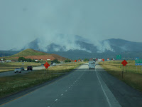
From the exit at Spearfish we had a view of our first forest fire...the Crow Peak fire, started by lightening during a recent thunderstorm, burned for over a week in the rugged timbered land.  Smoke from the fire could be seen for quite a distance and filled nearby canyons depending on the wind direction. 

Sturgis, Deadwood & Lead, South Dakota


It was a short drive from Heartland RV Park in Hermosa to Rush-No-More Campground in Sturgis, SD.  From there we explored the towns of Sturgis, Deadwood, and Lead.


Sturgis was a quiet little town, but that changes dramatically every August when hundreds of thousands of visitors arrive for its world famous motorcycle rally.  We found many of the downtown stores minimally open, but busily preparing for the upcoming event.  We stopped to see Knuckles Bar with all it's motorcycle memorabilia.

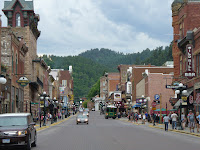
Deadwood, a historic mining town with lots of local stories of gold, gambling, and rowdy characters, was fun to visit.  We saw the saloon where Wild Bill Hickok was shot, and the cemetery (Mt. Moriah) high above main street where he and other local characters (Calamity Jane, Madam Dora DuFran, Potato Creek Johnny, Preacher Smith, Seth Bullock and Colorado Charlie Utter) are buried.  A tram tour took us to see the historic sites.

Lead, site of the Homestake Gold Mine from 1870's until 2002, one of the longest continually operating gold mines in America.  It is also recognized as the oldest, largest, and deepest mines (shafts descend more than 8000 feet below the surface) in the western hemisphere. Since closing it has been re-purposed by Sanford Lab as a Deep Underground Science and Engineering Laboratory.

Wind Cave National Park


Not far from the Mammoth Site in Hot Springs is the entrance to Wind Cave National Park.
Established in 1903, this was the eighth national park created and the first to protect a cave. Now with over 140 miles of mapped passageways, it is one of the longest caves known.  "Boxwork," an unusual formation found within the cave, is unique to Wind Cave. The natural entrance to the cave is a sacred site to local native Americans.

Above the surface, the park is a protected home for wildlife, including a herd of bison.  Elk, mule deer, pronghorn antelope, and prairie dogs are also found.

Also on site are buildings and structures dating back to the 1930's built by the Civilian Conservation corps.  We did not tour the cave itself, but spent lots of time viewing the extensive displays at the visitor center.

The Mammoth Site of Hot Springs, SD


The Mammoth Site is the final resting place for large Columbian and Woolly mammoths that became trapped about 25,000 years ago.  It is believed the animals were drawn to this spring-fed sinkhole, then slid in and were unable to escape.  So far remains of 61 of the huge animals have been discovered. 

Accredited by the American Alliance of Museums, this in-situ (bones left as found) site is an actively working excavation.  The entire site is now located within a huge building, to protect the bones from weather damage. In addition to the mammoths, bones of camels, wolves, and giant short-faced bear have been found.


Custer State Park & Black Hills National Forest, South Dakota


After leaving the Badlands, we settled into a campground near Hermosa, SD.  It was south of Rapid City, but gave us good access to Custer State Park and the South Dakota Black Hills.
   In Custer State Park we drove the Wildlife Loop Road and saw bison (buffalo), wild burros, deer, elk, antelope, and prairie dogs.  Another day we followed the Needles Highway...full of twists and turns, narrow tunnels, and towering rocky peaks.  Iron Mountain Road was our final route within the park.  It is known for it's pigtail bridges and tunnels that are strategically placed so the openings frame Mount Rushmore.


From the town of Custer we drove to Keystone to see Mount Rushmore National Memorial. Along the highway we could see Crazy Horse Memorial, a work in progress but now with a definite face appearing in the rock. We took day trips driving through Black Hills National Forest, and went into Rapid City for groceries and supplies. We spent a total of 10 days in this area, and drove many miles with the Honda!

Prairie Homestead National Historic Site


Prairie Homestead is located near one entrance to Badlands National Park.  This site preserves one of the only known intact original sod farm houses on the prairie.  This pioneer home was built in 1909 when the land was homesteaded by Mr. & Mrs. Ed Brown who came from Nebraska. The 160 acre homestead cost them $80.  The home was built of dirt sod bricks. After they left, it was occupied until 1949 by Mr. George Carr.

All the buildings are as they were found, except for minor restoration and maintenance.  A storage cave dug into the hills had collapsed, so it was dug out and restored in 1966.

In 1974 the site was added to the National Register of Historic Places. 

Badlands National Park South Dakota


 Badlands National Monument was established in 1939 and became Badlands National Park in 1978.  At one time the proposed name for this park was Teton National Park to avoid the negative-sounding name "Badlands".   It's 244,000 acres contain rich fossil beds, deep canyons, towering spires and flatland buttes.  Erosion by wind and water is constantly changing the appearance of Badlands rock structures.
We spent several days exploring Badlands National Park from our campground at Interior, SD.   We drove scenic Hwy 240 through the park. This Loop Road follows the Badlands wall, a long narrow spine of formations that stretch for some 60 miles. Our National Parks Golden Pass allowed us to enter many times.  


At the end of our drive one day we were lucky enough to see some bighorn sheep wandering along the road and resting on stone ledges not far away.


A vacation in the Badlands would be incomplete without a trip to Wall Drug.  It seemed bigger and contained lots more shopping than we remembered from previous trips.

Toward the Badlands

We left Minnesota in June and headed West...first stop was Watertown, South Dakota.  We camped there a couple days at Stokes-Thomas Lake City Park...a nice park right on Lake Kampeska. Watertown has an impressive Terry Redlin art museum/gallery on the east edge of town near the junction of I-29 and highway 212.

Next destination was near Gettysburg, South Dakota.  We chose a campsite at South Whitlock Recreation Area, a huge area along the Missouri River with access to Lake Oahe.  Formed by a dam near Pierre, SD Lake Oahe is a very active fishing lake.  In the fall the area supports pheasant and deer hunting.

A road trip one day lead us to Hoven, South Dakota, a little town of about 500 persons.  What puts this little town on the map is its Cathedral of the Prairie (St. Anthony of Padua Catholic Church). Completed in 1921, and now registered as a historic place, the massive church seats over 1000; twin spires reach 140 feet toward the heavens; the interior walls are covered with intricate, ornate stenciling.  It is believed to have been patterned after a church in Bavaria.  A walk through the cemetery revealed a gravestone containing a familiar family name!  Some of our relatives had been here...

From Gettysburg we drove south through Pierre then toward Rapid City. While driving along highway 14 we learned we were following the "Old Deadwood Trail"....signs along the way marked sites where stage coach stops had once been and where wagon wheel ruts were still visible in nearby fields.

Monday, May 16, 2016

Buddy Holly Experience

During our travels in April, 2016 we found ourselves in Lubbock, Texas...birth place of Buddy Holly.
We spent some time at the Buddy Holly Center which features a permanent exhibit on the life and music of Buddy Holly. 

Personal collections from his family tell about his early life: born September 7 1936 in Lubbock, Texas Charles Hardin Holley (nicknamed Buddy) was the youngest of four children. Musical talent ran in the family, and the children were encouraged to play. 

In junior high (1949) Buddy and a friend Bob Montgomery formed a band and played for local events.  In 1955 Buddy was offered a recording contract with Decca Records in Nashville, but most of his recording was done in Clovis, New Mexico.  Norman and Vi Petty Recording studio helped develop the sounds and talents of the Crickets and Buddy Holly.  As a side trip, we drove to Clovis and toured the Norman and Vi Petty Rock & Roll Museum, and drove by the recording studio building.  

His career was cut short when a plane crash in 1959 near Clear Lake, Iowa took Buddy's life.  We saw his gravesite in Lubbock.

Wednesday, May 4, 2016

White Sands and Pistachios

From Deming we set up camp in Alamogordo, NM.  We spent one day exploring White Sands National Monument.  Located in the Chihuahuan Desert of Southern New Mexico, White Sands National Monument is the world's largest gypsum dune field, covering 275 square miles.  Layers of gypsum buried in the surrounding mountains are eroded by wind, rain, and snow and deposited into a shallow lake bed. Crystals form as the water evaporates; the crystals are broken smaller and smaller by strong south west winds.  The winds blow the crystals into dunes, which are continually shifting. In this stark white environment native lizards and mice have evolved lighter body colors, to protect them from predators.

Touring a pistachio farm was another agenda item.  We learned New Mexico is 2nd largest producer of pistachios in the US.  Our guide showed us both male and female trees, and we observed new nuts just starting to form.  We learned how the nuts are harvested (by shaking the tree), sorted, stored, and roasted. And, we were able to sample and purchase some of the tasty treats before we left for the day.

City of Rocks State Park New Mexico


From Deming, NM we drove to City of Rocks State Park.  The rocks forming City of Rocks were produced by a very large volcanic eruption that occurred millions of years ago.  During this violent eruption large volumes of ash and pumice were deposited on the earth surface.  This would have been followed by a hot molten layer that welded the ash and pumice into dense rock.  Over time cooling caused long perpendicular cracks to occur.  These cracks widen with erosion processes such as freeze-thaw and wind, along with roots of vegetation that eventually grew in the cracks. 

 The end result are the large pillar-shaped rocks that appear to jump up from the surrounding desert floor.


Tuesday, March 29, 2016

Verde Canyon Railroad


Verde Canyon Railroad carries passengers on a 20 mile trip through the Verde Canyon. The 4 hour journey takes you from historic Clarkdale, AZ (near Jerome) to the Perkinsville ghost ranch and back again.  From the vintage restored train cars and/or open air viewing cars one can observe the natural beauty of the canyon, two national forests, and protected wilderness areas.

 The historic rail line runs through an area where high desert meets riparian wetlands along the Verde River.  Towering rock formations, clear water streams, ancient ruins, bridges and trestles are all part of the trip.  Most interesting is the 680 foot man-made curved tunnel which was chiseled  through solid rock over a century ago...for a short while you are surrounded by complete darkness, until the cars emerge from the tunnel again.

Monday, March 28, 2016

Yuma Territorial Prison

High on a bluff where the Colorado and Gila Rivers meet in Yuma, AZ is the site of Yuma Territorial Prison.  Now a historic state park, the prison once had the reputation of being the most feared prison in the west.  Before the prison was built a military fort was located nearby.  In 1850's the Gold Rush led many individuals to the west and the town of Yuma flourished. By 1875 the need for a territorial prison was recognized.  Built by the prisoners themselves, the first were jailed in 1876.  

One of the more famous prisoners was lady stage coach robber Pearl Hart...rumor is that after she robbed the stage, she gave each passenger $1 back so they could get something to eat or drink at the next stage stop! 

For the next 33 years it served as a prison. After that prisoners were moved to a new facility in Florence, AZ.  Once the prisoners left, the facility had other uses.  From 1910-1914 it served as a temporary High School for Yuma (the athletic teams name..."The Criminals").  From 1914 to 1923 it was a hospital.  In the 1920's and 30's Depression era homeless families and hobo's occupied the cells as temporary homes. It was neglected for some years, then in the 1960's the park service began restoring it as a historical site.  Now one can tour the prison
cells, guard tower, and the dreaded "Black Hole"...a cell without windows where those who failed to follow rules were shackled.

Imperial Sand Dunes National Recreation Area


While in Yuma, AZ for a few days, we drove west on I-8 into California to observe the massive sand dunes of the Imperial Sand Dunes NRA.  More than 127,000 acres of wind swept sand is piled into dunes, some up to 300 feet high...it has created a massive sandbox for off-road vehicle enthusiasts to play in.


History lurks here too with the preservation of remnants of the Plank Road. The Plank Road was originated in 1915 to provide a route from Yuma, AZ to San Diego, CA which did not involve driving all the way to Los Angeles first.  San Diego merchants helped raise money to bring the planks and construct the 6 1/2 mile Plank Road across the shifting desert sands.  The road consisted of two parallel tracks, each 25" wide spiked to wooden cross pieces underneath.  In April, 1915 work was completed and the first automobiles traveled the new route....they declared it a success!  However, with time and wind against them, the planks would shift and move and create a difficult mess.  Drivers often had to stop and put the planks back in place to continue their travels...it became known as the "Do-It-Yourself Highway".
In 1916 the California Highway Commission developed improvements that kept the Plank Road in place and provided more stability.  However, the road was still not wide enough for two cars to pass and occasional disputes resulted.  Pull-out and passing areas were added. The road was used until 1926 when a two-lane asphalt road was built to replace it.

Preserved sections of the Plank Road can be seen in place at a site near Gray's Well Road.

Sunday, January 10, 2016

Natchez Trace Parkway

Stretching from the Mississippi River in Natchez, Mississippi through the Shoals area in Alabama and across the Tennessee Valley to Nashville, the Old Trace was first used by American Indians.  In the early 1800's it became the main route to the Ohio Valley for traders and pioneers. In 1801 President Thomas Jefferson designated the Trace as an official post road to be used for mail delivery between Nashville and Natchez.  Inns and stands were established along the route by early travelers to provide lodging, food, and drink for other travelers.

Today The Trace is a 444 mile National Scenic Byway, administered by the National Park Service.  It provides a non-commercial (no big trucks allowed!) unhurried drive through historic and scenic landscapes.  Speed limit on most of The Trace is 50 mph.

We left The Shoals on November 16, 2015 and picked up The Trace off US Hwy 72 in Alabama.  We drove 227 miles south to an exit north of Jackson, MS...our campsite was near Ross R. Barnett Reservoir in Brandon, MS.

Along The Trace we stopped to investigate some of the wayside exhibits and historic markers. Indian Mounds, campgrounds, and a Cypress Swamp (photo right) were just a few examples of the variety to be found.

After a couple days in camp waiting for severe thunderstorms, heavy rain, flash flooding, and tornadoes to pass to the East, we followed The Trace a few more miles to I-20, where we headed West.

Coon Dog Memorial Cemetery

Before leaving the Red Bay, AL area we drove to Key Underwood Coon Dog Memorial Graveyard. This cemetery in rural Colbert County is reserved specifically for the burial of coon dogs.  Established in 1937, the cemetery is now the final resting place for over 300 coon dogs.

Three requirements must be met in order to be considered for burial here:
1) the dog owner must claim that his pet is an authentic coon dog
2) a witness must declare the deceased to be a coon dog
3) a member of the local coonhunters organization must confirm the fact.

It is thought to be the only graveyard of its kind in the country.

The Shoals Area of Alabama

From Nashville we drove south...we had scheduled appointments for some motor home inspections, maintenance and repairs in and around Red Bay, AL.  Campsites near Red Bay were filled, so McFarland Park near Florence, AL became home base.  McFarland Park was right on the Tennessee River not far from Wilson Dam; we could sit outside and watch tugboat guided barges coming and going on the river.

We had time to visit The Shoals "Quad Cities" of Florence, Sheffield, Tuscumbia, and Muscle Shoals. Music history was everywhere...the Shoals sound originated here, a blend of soul, gospel, country and rock, that found its way into many popular tunes.  W.C. Handy, "Father of the Blues" was born here; the Alabama Music Hall of Fame and Fame Recording Studio were close by.  We also saw Helen Keller's birthplace and Spring Park Waterfall in Tuscumbia.  In historic downtown Florence we saw Pope's Tavern site...once a country tavern, it became a hospital during the Civil War for both Confederate and Union soldiers...it is now a museum.

Friday, January 8, 2016

Nashville Tennessee

Our next destination was Nashville, TN where we parked a couple days at the KOA near Opryland. Old friends from Minnesota, now in Nashville, took us to dinner one night at the Gaylord Opryland Resort and Convention Center.  It was a huge place, the courtyards and various restaurants filled with plants and flowers. Waterfalls and a "river" with riverboat rides added to the scenery; balconies on interior rooms reached over the space...plus, they were adding decorations for the Christmas holidays.  We enjoyed both the dinner and the scenery.

The next day was a backstage tour of the Grand Old Opry.  We got to see the entertainers entrance, their dressing rooms and private mailboxes, the main opry stage, and Studio B where shows like Hee Haw were performed.

For a Nashville history event we went to tour The Hermitage: Home of the People's President Andrew Jackson. "Old Hickory" is probably most remembered for engineering a win over British troops in the Battle of New Orleans in 1815.  His farm, home, gardens, and slave cabins are being preserved; audio tours provide information about his family and his life.

Great Smoky Mountains

After leaving Pennsylvania, we headed south on I-81across the Potomac River and the Mason Dixon Line, then through the Appalachian and Blue Ridge Mountains.  Our destination was Sevierville, Tennessee in the foothills of the Great Smoky Mountains. 

Great Smoky Mountain National Park, established in 1934, has become one of the country's most visited parks.  It was very crowded the day we drove through, but the scenery and vivid colors of the hardwood forests was worth the effort.

We learned that Sevierville is hometown to country music star Dolly Parton...a bronze statue on the courthouse lawn, Dolly Parton's Dixie Stampede, and Dollywood theme park are located there.

 The towns of Sevierville, Pigeon Forge, and Gatlinburg provide lodging, entertainment and shopping for everyone...from local arts and crafts to brand name outlets, zip-lines to zoos, and lots of live music and comedy shows, plus restaurants and cafes of every kind! 
Sevierville is also home to Bush Brothers and Company Visitor Center, where you can learn all the required steps to preparing that American standby: Bush's Baked Beans.

Fall 2015 Travels

We left Minnesota mid-October, 2015 and headed east to Pennsylvania.  It was a late fall season, so we saw lots of fall color on the trees as we drove through Iowa, Indiana, and Ohio and the rolling hills of western Pennsylvania.  We stayed about 10 days at Pine Hill RV Park, not far from Allentown-Bethlehem-Easton area.  From here we could visit family and do some sightseeing.


 Lehigh Valley Zoo near Schnecksville, PA was a very kid-friendly place to roam around for part of one day. The drive there took us on winding roads surrounded by colorful leaves and small farms.
 
Another day was spent at the Easton Farmers Market, said to be the oldest continuous running open-air market in the country.  A visit to Dietrich's Meat and Country Store (just down the road from the RV park) in Krumsville, PA took us back to the meat markets we remembered from the past...lots of fresh and smoked meats plus Pennsylvania Dutch specialties like Shoo Fly Pie and fresh baked breads. Near there was a local winery with some very good Concord Grape Wine.  By the end of October we had to move on, as the campground was preparing to close for the season.