Monday, November 18, 2019

Hoover Dam and Lake Mead


Hoover Dam, originally Boulder Dam, was constructed between 1931 and 1935.  Thousands of depression-era workers found jobs there. Many lost their lives.

This large concrete, arch-gravity dam is located in the Black Canyon of the Colorado River, between Nevada and Arizona. Powerful generators use water flow to produce electricity.  Lake Mead formed as a result of the dam. It is one of the largest reservoirs in the US, supplying water to western states, and providing a water-sports recreation area.

When we last visited 30+ years ago, the top of the dam was highway 93 across the river.   We stopped there to look at the dam over the edge of the railing...Now the landscape around the dam has changed.

 A new bridge completed in 2010 crosses the river downstream from the dam; viewing platforms, walkways, and observation areas line the top of the dam. Multiple parking areas are connected to the walkways. Tours are available.

Saturday, November 16, 2019

Death Valley: Racetrack Playa

The mysterious sliding rocks of Racetrack Playa were one feature we were unable to see while in Death Valley National Park.  The Racetrack, a dried lakebed nestled in the mountains, contains boulders that leave tracks in the mud, indicating that they have wiggled, jiggled, slipped and slid across a perfectly flat area. These "sliding stones" have been studied by scientists, but no one has actually seen them move.  Recent observations using GPS and time-lapse photography have started to show some insight as to how the boulders move.

To get to this area one must drive 27 miles on an unpaved rocky dirt road. High-clearance vehicles with heavy-duty tires are recommended. And check with a park ranger for road conditions!

Death Valley: Mesquite Flat Dunes

Located near the village of Stovepipe Wells, Mesquite Flat Dunes area contains acres of white sand dunes, some as tall as 150 feet.
Sand that forms these dunes originates in the Cottonwood Mountains just north of the dunes field. Quartz and feldspar rocks are broken by erosion, and eventually become sand sized pieces.  Winds cause the sand to blow into ever changing piles.

 This area can be explored on foot, after parking in one of the access points along the way.


"Devil's Cornfield" is the name given these unusual looking formations that occur as sand dunes form around the mesquite plants that dot the area.

Death Valley: Furnace Creek Area

A variety of sights exist within the Furnace Creek Area of Death Valley National Park.  All the following are accessible by car, and fairly easy walks from parking to observation areas. A Visitor Center and Museum are located at Furnace Creek.


Artist's Drive exposes mineral deposits in a palette of colors in the volcanic formed rocks.  Pullouts are available for short term parking and photos.


Badwater Basin allows visitors a chance to stroll through the basin of an ancient lake.  What remains are layers of salt deposits.  At 282 feet below sea level, it is the lowest point in North America.


Dante's View, an observation area more than 5000 feet above sea level, allows one to view the expanse of Death Valley.  From high above it is easy to see the distinct valley between ranges of steep mountains. Access is via a steep, winding hard surface road. The last 1/4 mile is a 15% grade!


Zabriskie Point may be one of the most popular lookouts. A short uphill climb from the parking lot allows one to see a panoramic view of golden brown mudstone hills etched with gullies from the occasional intense rainfalls this area experiences.


Harmony Borax Works

Harmony Borax Works is one of the historic sites located with Death Valley National Park.  Borax was found in the hills by prospectors in 1881.  This processing plant operated from 1883 to 1888.  Forty workers produced 3 tons of borax daily.  Ten teams of 2 mules (the famed 20-mule teams) pulled the loaded wagons 165 miles to the nearest railroad town.  It took about 30 days to complete a round trip.  This site has rusty remains of buildings, machinery, and tanks used for processing the borax.
Informational signs explain the site; a museum is located at Furnace Creek Ranch.

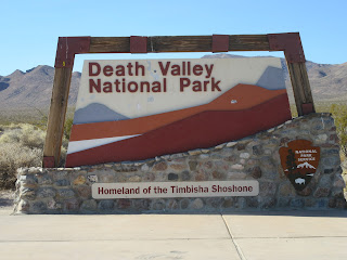
Death Valley National Park

Death Valley National Park is the largest national park outside of Alaska. The land started as a National Monument in 1933 then gained National Park designation in 1994. With over 3 million acres of wilderness, a diversity of scenery is there to explore.  Rocky peaks, twisted slot canyons, shifting sand dunes, and the below sea level salt flats are only some examples.  There are historic sites, hiking trails, visitor centers, lodging and camping.  Death Valley National Park is also a designated Dark Sky Park, for night sky viewing enthusiasts.  The park is open all year, but with summer temperatures frequently reaching 120 F or higher, the months of November to April provide more comfortable visiting conditions. 

Thursday, November 14, 2019

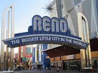
Reno/Lake Tahoe

One day we drove through Reno, Nevada, then on to Lake Tahoe. Guide books stated Reno is the second most populated place in Nevada. University of Nevada, Reno occupies one section of the city. National Automobile Museum offers a chance to see vintage cars. And there are casinos for entertainment.


Lake Tahoe area in the Sierra Nevada Mountains is known for winter sking and summer water activities.  We observed kayaks and fishing boats on the lake. We drove a winding mountain road to Mt. Rose Ski Area, elevation 8260 feet, and saw some snow...

Sundial Bridge

Sundial Bridge crosses the Sacramento River in Redding, California.  Opened in 2004, this glass decked suspension bridge spans 708 feet across the river. 

Redding's Civic Auditorium and Turtle Bay Exploration Park are nearby.  Walking and biking trails along the riverfront, botanical gardens, an arboretum, and natural history museum are linked by the bridge.