Monday, September 22, 2014

Lady Slipper Scenic Byway

After our first night at Leech Lake campground we planned a day of sightseeing.  We left the park by car and traveled north from Federal Dam, MN to Highway 2.  On our way west to County Road 39 another photo op appeared: The Big Fish Supper Club.  They advertise "we will cook your fish"; did I mention we are in serious fishing country?


Traveling north on County Road 39 we drove through Chippewa National Forest on our way to Blackduck, MN. We stopped for gas along the way and inquired about interesting places to visit...just a ways north was Rabideau CCC Camp.

In the 1930's, after the Depression, Franklin Roosevelt established the Civilian Conservation Corp (CCC) to provide jobs and work skill training for young men ages 16-25.  The men stayed in camps like Rabideau; they built bridges, roads, and campgrounds, planted trees, established firetowers and fought forest fires. Some earned high school diplomas if they attended classes held at the camp.  Barracks for sleeping, a mess hall, hospital and dental clinic, tool shop and more were part of each camp. Workers earned $5 per month and $25 per month was sent to their family.  By 1941 the CCC program ended.   Of the 2600+ CCC camps started in the United States, the camp at Rabideau is one of three that has been preserved.  Fifteen of the original 25 buildings are restored; they were placed on the National Register of Historic Places in 1976.

After our self-guided tour at the CCC camp we continued into Blackduck for lunch at a local cafe.  On the entrance to town, in the park, was another statue...a large black duck...we had to stop!

Then it was on the road again, south toward Cass Lake, then into Walker for some shopping and back to the campground.  Fall color was more noticeable here, with vivid red's, yellow, orange, and gold leaves among the green pines...

The next morning we were on our way toward home.  We followed Highway 65, a familiar route from our days going back and forth to the cabin.  Many old landmarks still existed!


Leech Lake Recreation Area

After two days we broke camp at Maplewood State Park and headed northeast...  At lunch time we were in Park Rapids, and stopped at the Tourist Information/DNR parking lot for a break.  What did we see but another large icon of Minnesota...a loon, complete with baby on her back.  A photo was definitely in order...

From Park Rapids we drove toward Leech Lake. Located in the Chippewa National Forest, Leech Lake has 316 miles of shoreline.  It is the third largest lake in Minnesota.  Our destination: U.S. Army Corp of Engineers Park at Leech Lake.  We would be camping there the next two nights.


Corp of Engineers manages the dam located on Leech Lake River at the outlet of Leech Lake.  It was originally constructed in 1882 as part of the Headwaters reservoir system...designed to feed water to the Mississippi River and keep river levels high enough for use by logging and milling industries, and for an alternative to traveling by rail. The wooden dam was reinforced with concrete abutments in the early 1900's.   In the 1970's the Corp's mission of regulating river levels switched from logging and river travel to recreation.  The surrounding recreation area offers opportunity for camping and fishing.  Most sites in the campground were occupied by some serious fishermen...

Once we arrived, we drove around the park and picked a site nestled in the hardwoods and pines...

Sunday, September 21, 2014

Otter Tail Scenic Byway

We left Maplewood State Park for a day of sightseeing, and followed the Otter Tail Scenic Byway through a number of small towns in the area.  First stop was Pelican Rapids, and a trip to the local park to see "The Worlds Largest Pelican".  Built in 1957, at 15 1/2 feet tall,  he stands next to Mill Pond Dam where the Pelican River flows through town. One unusual fact about the Pelican River is that it flows north...

Next stop was lunch in Detroit Lakes, MN.  Along the way into town we passed the site of WeFest.  WeFest is one of the largest outdoor country music & camping events in the nation.  Held at Soo Pass Ranch, visitors can camp and be entertained at one site; shuttle service takes visitors to downtown locations as needed. The entire three day event attracts thousands of fans every summer.

From Detroit Lakes, we stopped in Frazee, MN.  Signs along the highway told to stop and see "Big Tom", the worlds largest turkey gobbler statue in the world!  At 22 feet tall, Big Tom sits at the entrance to the local public park.  Tom has been a fixture in Frazee since 1986, being replaced in 1998 when the original Tom burned to the ground in a renovation blowtorch accident. Large turkey farms located nearby explain the significance of Tom to the community.

Our last stop before returning to the state park was the town of Perham, MN.   Tuffy's Dog Food and Barrel O'Fun snacks are two large industries in this small town.  We also located the homeplace where our neighbor grew up years ago...


From Perham, it was back to the park to relax and enjoy a crackling campfire...

Maplewood State Park

Maplewood State Park, located 7 miles east of Pelican Rapids, MN on State Highway 108, was our home for the first two nights of a week long RV trip to do some "leaf color watching" in northern Minnesota.


This State Park, established in 1963, is a recreational area of about 9000 acres.  It is located in a geological transition area between the state's eastern forests and western prairies.  The hills (some up to 1600 feet elevation) within are covered with hardwood trees: sugar maple, basswood, elm, and aspen.  Occasional red cedars and tamarack are also found.  Lakes included within the park include Lake Lida (the largest), Beers Lake, Grass Lake, Bass Lake, Field Lake, and many smaller ones. 
Our campsite was next to the shores of Grass Lake.  Fishing, hiking, horseback riding, swimming, and camping are summer activities.  In winter, trails are used for skiing and snowmobiles.

Fall color was just starting to appear in the maples...

Tuesday, August 19, 2014

"Up North" Minnesota

On our first RV trip since returning to Minnesota, we headed "Up North" to Two Harbors, MN.   We had reservations at Burlington Bay Campground, located on the shores of Lake Superior, for a rally with members of the RV club... We arrived on Thursday afternoon (August 7th) and stayed until Sunday.

The North Shore scenery was great, and we had excellent weather.  On Friday, Gene and I went to explore Gooseberry Falls State Park, just north of Two Harbors. We saw the Falls near the Highway 61 bridge, where the Gooseberry River tumbles nearly 30 feet as it makes its way to Lake Superior. After some hiking on the trails, we stopped for lunch at a rustic restaurant known for it's homemade pie.

On Saturday we explored Two Harbors.  This small town on the big lake continues to be a busy shipping port, and it's harbor at Agate Bay has some of the largest ore docks in the US.  From shore one can watch 1000+ foot ships being loaded with iron ore. Ore arrives by rail from mines on the Minnesota Iron Range.  The ore is unloaded from the train cars into huge bins on the ore docks.  The bins are emptied via chutes that are lowered to fill the ore ship's massive cargo hull.  Once filled, the ore ships head back to the lake to deliver the iron ore...


Near the ore docks, we toured historic Two Harbors Lighthouse, which was constructed in 1892, and remains today as the oldest operating light station in the state of Minnesota.  The lighthouse
also serves as a Bed & Breakfast operated by the Historical Society.


While on our history tour of Two Harbors, we also visited The Edna G, one of the last steam powered tugboats to work Agate Bay.  It was placed on the National Historic Register in 1974.  Nearby was the Railroad Museum, filled with exhibits of Lake County's pioneer days, including logging, mining, railroading, and fishing.


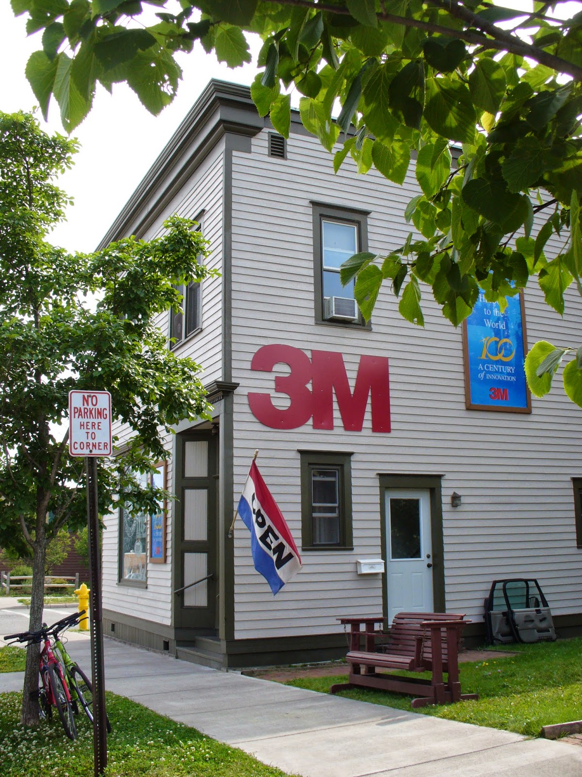
A tour of Two Harbors would not be complete without visiting the 3M Museum.  The museum is located in the original 1902 office building where 3M had it's beginnings...exhibits within highlight the development of 3M products from sandpaper to scotch tape!

Tuesday, April 22, 2014

Total Lunar Eclipse

On April 15, 2014 there was a total lunar eclipse.  As we were conveniently located at a RV park in northeastern Kansas, away from city lights, Kathy made plans to observe the event.  Weather folks and meteorologists on TV predicted approximate viewing times for our area...before going to bed a look out the window showed a bright full moon and no clouds.  Perfect!
    Kathy set an alarm for the assigned event time, but managed to wake up before it sounded...through the motorhome front window she was able to watch as the moon passed through the Earth's shadow; the moon finally became completely in shadow, then the colors began...indirect sunlight, filtered and refracted by Earth's atmosphere caused the moon to flicker with a reddish-orange-gold hue.  It was very neat to see!!
   (Note: to our more scientific followers...hope this is an accurate explanation of how a total lunar eclipse occurs!)

Thursday, April 3, 2014

Organ Pipe Cactus National Monument

Organ Pipe Cactus National Monument is located south of Ajo, Arizona and extends to the border with Mexico. This section of the Sonoran Desert was established as a national park in 1937, primarily to preserve this environment from land use development.  In 1976, this area was declared an International Biosphere Reserve site by the United Nations because of it's plant diversity; rare and endangered species; and delicate ecosystems. Sonoran pronghorn deer, a tiny fish called a pupfish, and the Sonoyta mud turtle are a few of the vanishing species who call this region home.
    The Organ Pipe Cactus is common to Mexico, but is rarely found in the United States.  In fact the National Monument site is one of the few places in the US where large stands of these cacti exist.  The organ pipe cactus can live up to 150 years; it produces it's first flowers at age 35.  The flowers blossom at night, so they can be pollinated by bats, then close by mid-morning the next day.  
    Two scenic drives on winding, graded dirt roads take you into the desert valleys and canyons.  Hiking trails lead to the remains of historic ranch and mining sites.  Campsites and picnic areas are also available.